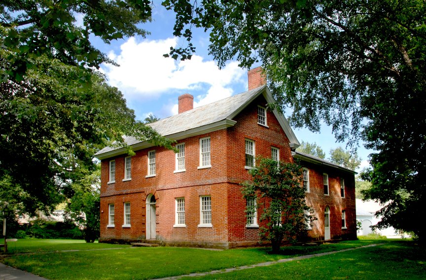
By Claire C. Carlson, Director of Archaeology
October 2021 marks the 40th annual Massachusetts Archaeology Month and provides us with an opportunity to provide an update on the fieldwork done so far in the Stebbins House Archaeology Program. The Asa and Emilia Stebbins house is now closed for restoration. Staff have compiled extensive documentary research, and under the direction of the museum’s Director of Historic Preservation, Eric Gradoia, a thorough study phase allows Historic Deerfield to develop a comprehensive understanding of the Stebbins House. By re-examining the historical record, including compiling all known archival documents pertaining to the history of the site, the people who lived within these walls (from the Stebbins ownership to the present day), and the building itself, Historic Deerfield staff are constructing a chronology of the life of the occupants as well as the evolution and uses of the site.
The Archaeology Program supports the historic preservation project at the Stebbins House and is motivated by our mission statement to open doors to new perspectives that inspire people to seek a deeper understanding of themselves, their communities, and the world. The archaeology program at the Stebbins House provides opportunities for the museum to learn more about this site, expand its 19th-century histories, and involve community members as students, researchers, and visitors to the project.
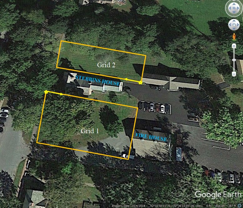
The first round of archaeological fieldwork at the site was conducted in the Fall of 2020 and the Spring and Summer of 2021. Operating under a permit issued by the Massachusetts State Archaeologist, the first phase of the field work involved a ground penetrating radar (GPR) survey that guided our excavation of a small number of test excavation units. GPR is a non-invasive tool used by archaeologists to locate potential features like privies, wells, and buried foundations of barns and outbuildings. The GPR survey was conducted by soil scientists from the United State Department of Agriculture Natural Resources Conservation Service. They split the site into north and south grid areas as shown below.
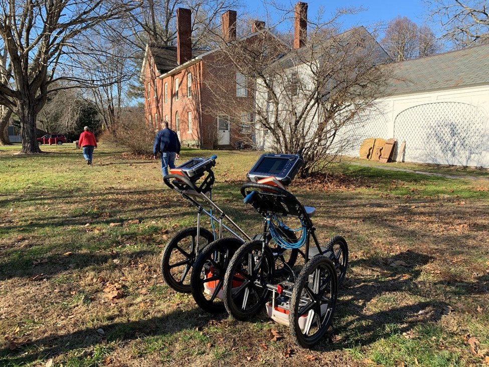
The data collection took a day of fieldwork, and the soil scientists prepared a report for Historic Deerfield that offers an interpretation of the results. They consulted with historic photographs and a map that we provided. They concluded that the north side of the house was severely disturbed by multiple overlapping utility lines that include water, gas, and sewer. Closer to the house the ground was less disturbed. On the south side of the house, they interpreted the readings to indicate the possibility for several buried features that included a potential walkway to the house and the buried foundations of three outbuildings. The walkway was determined to be electrical and water lines upon field inspection. The area showing the rectangular features was highlighted as a place with high potential.
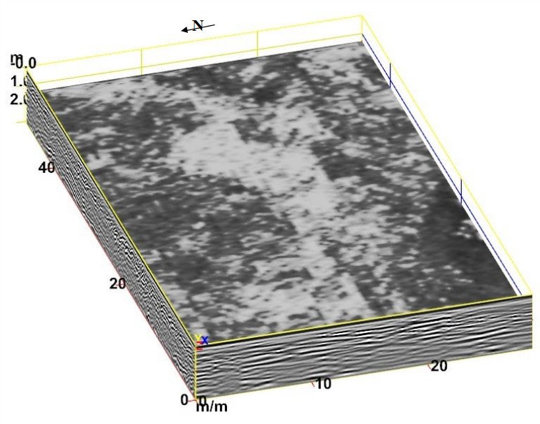
The museum’s research team is interested in identifying the locations of barns, outbuildings, wells, privies, fence lines, kitchen gardens, and ornamental plantings. Currently, the only extant outbuilding related to the Stebbins occupancy is a barn directly east of the house, which was converted to a storage garage in the 20th century. The results of the GPR survey were exciting and offered the potential for recovering new information about the use of the south lawn by the Stebbins family.
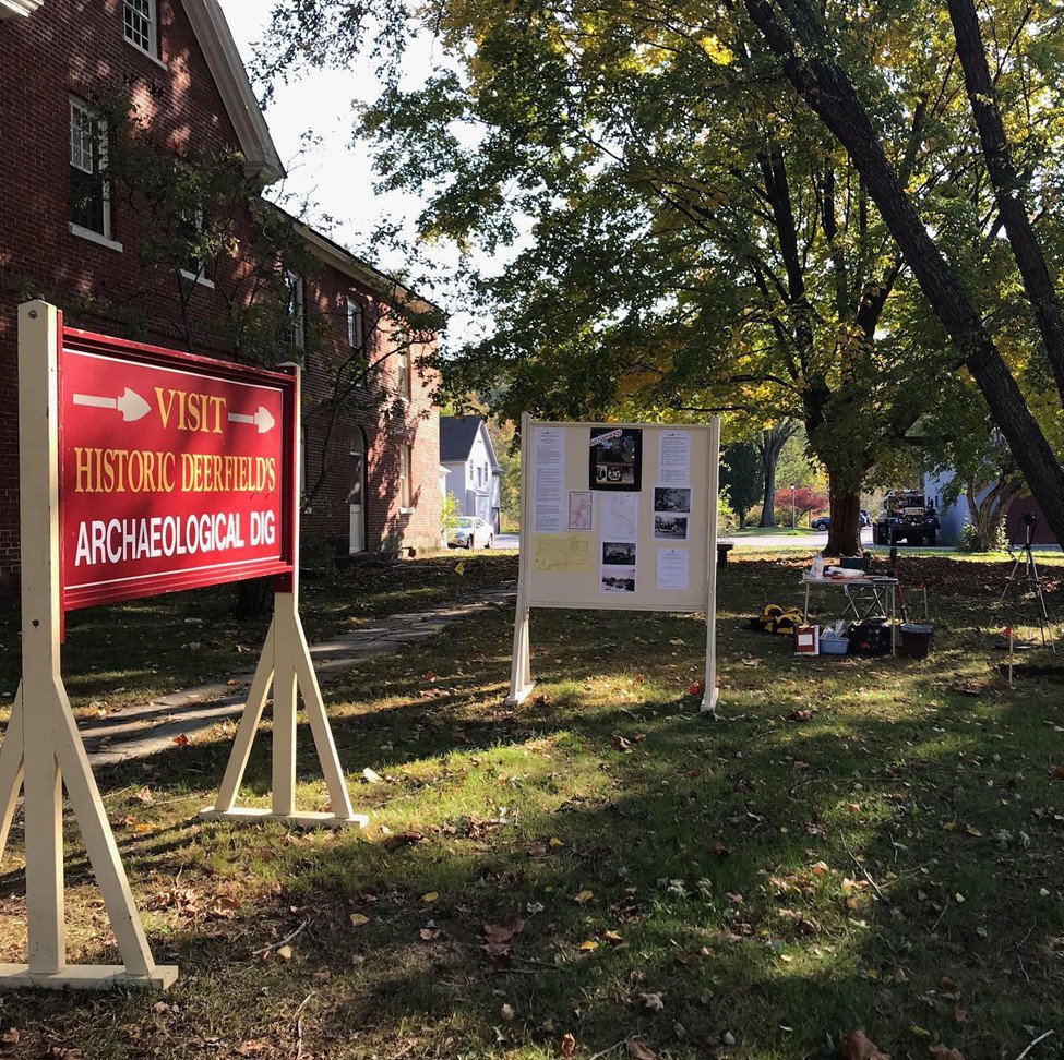
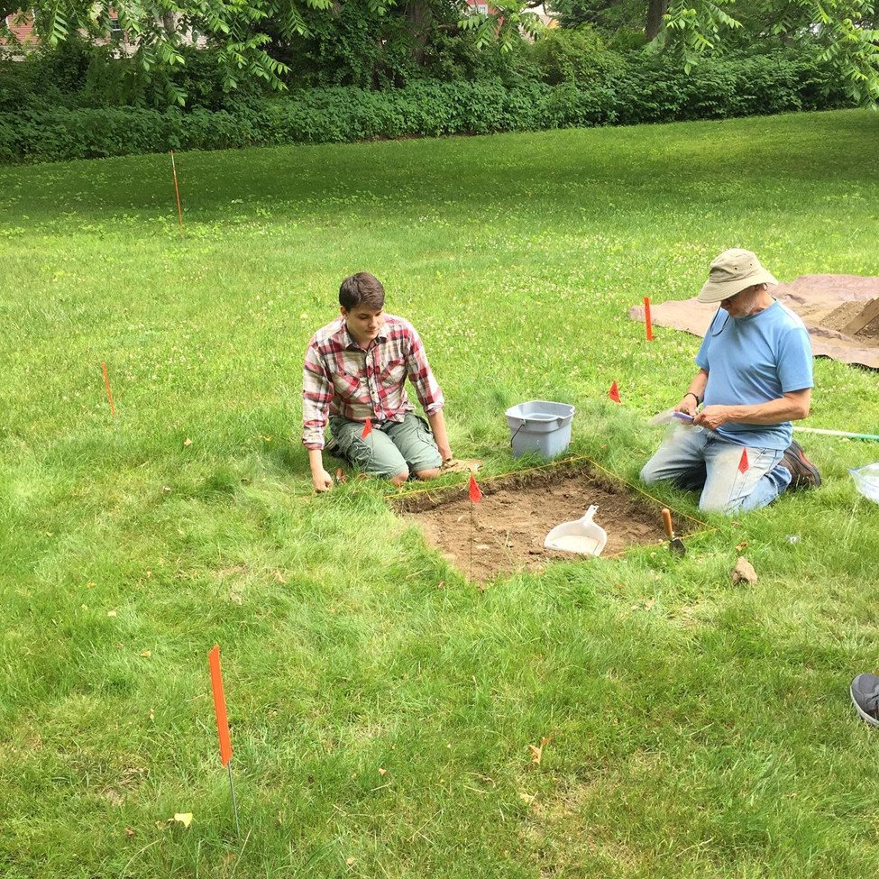
Field testing was conducted in the Fall of 2020 and the Spring and Summer of 2021. The location of the Stebbins House in the central area of town, across the Street from the Deerfield Inn, provided opportunities for interaction with the public while doing the excavation. This testing had two goals: to answer some of the questions that have arisen from the background research and GPR survey, and to allow museum guests to observe the dig and tour the site. For each day of fieldwork, we had a Historic Deerfield guide available to answer questions about the dig, explain images on the information board, and show artifacts that were recovered that day.
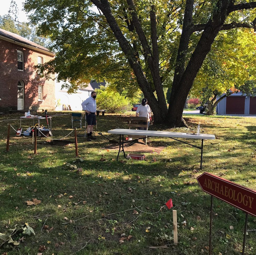
Four excavation units and one shovel test pit were excavated during our “Digging Deeper” program in the Spring and Summer of 2021. We were fortunate to have the “dream team” of volunteer archaeologists who generously donated their time and expertise to the project. They included professional archaeologists Rita Reinke, Eric Johnson, Amy Gazin-Schwartz, Chris Donta, Julie Woods, and Pete Thomas who worked closely with students Caitlyn Shannon, Zach Newton, Micaela Koller, and Quinn Schein. In addition, local surveyor Daniel Salls created a site map for the project and volunteered at the dig with his daughter, Mary. Historic Deerfield guide Todd Kmetz rounded out the field crew.
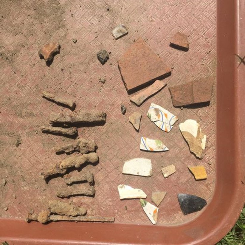
You are probably asking yourself, “ Well, what did they find? What were those rectangular features that showed up on the GPR scan? What kinds of artifacts and features were there at the site?” A consistent finding across the site (one unit on the north side of the house and three on the south) is that the north and south yards of the Stebbins House have been significantly impacted by episodes of digging and filling over the years. This is expected in a town like Deerfield and has been corroborated by other excavations on other homelots along the Street (e.g. Moors House, Frary/Barnard, Hinsdale and Anna Williams). A series of cuts and fills is to be expected as different landowners shape and reshape their properties. We did dig two units near the GPR anomalies. We dug down to depths that were deep enough to encounter them, however we encountered natural soils instead. This past season’s fieldwork will be evaluated after we process the artifacts and write a completion report for this phase. Most likely we will return to this area in the future. Every unit contained artifacts, and these are being washed and cataloged this fall and winter as we prepare site reports for submission to the Massachusetts State Archaeologist and the Historical Commission of the Town of Deerfield.
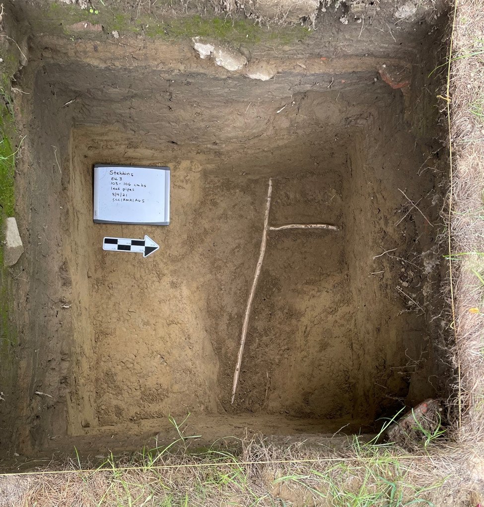
Our first season of archaeological excavation at the Stebbins House provides more questions than answers. A good example of this is the feature that we encountered at the very bottom on Excavation Unit 3, at about 1 meter (3 feet) below the surface at about 4:00 p.m. on the very last day of field work. Staying true to her nickname “ Four O’Clock Feature Rita,” volunteer archaeologist Rita Reinke discovered a set of narrow intersecting lead pipes at the bottom of the unit. Excavation Unit 3 was located about 10 feet north of the house. The pipes were confirmed to be water pipes, running in an east/west orientation, with a spur heading off to the north, away from the house. What does this mean? We will have to return to this area next year to find out! We will spend the upcoming winter months washing and cataloging the artifacts from the dig, preparing excavation unit plan and profile drawings, and writing a summary report that will help us plan our next season of excavation. Stay tuned for Fieldwork Update Part 2 in Spring 2022!