Maps and Prints
Documenting Early American Life
Historic Deerfield’s collection of maps and prints includes portraits (New England), landscapes, political and allegorical prints, and depictions of historical events. Housed in the Flynt Center of Early New England Life and the Memorial Libraries, and the historic houses (particularly the Ashley House), the collection focuses on prints and maps known to have been owned in Deerfield and the Connecticut River Valley.
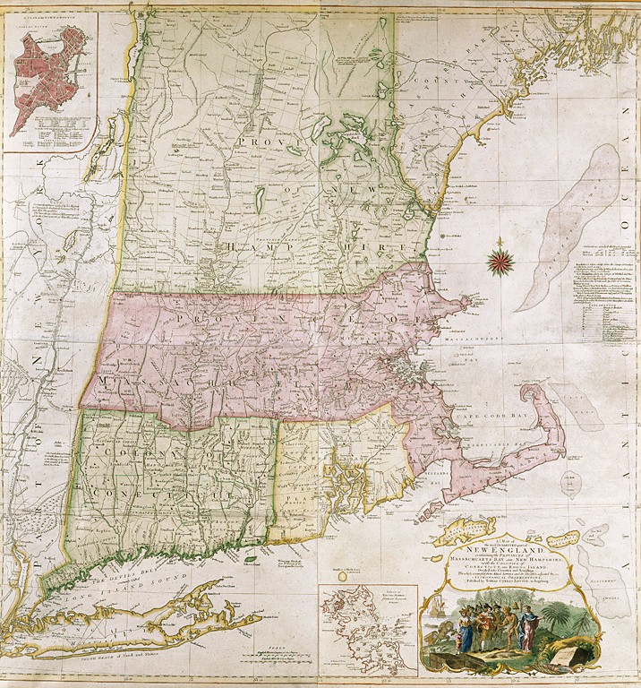
MAP
A Map of the most Inhabited part of New England, Tobias Conrad Lotter (1717-1777). Bavaria, Augsburg, Germany, 1776. Watercolor wash, printed ink, paper, cloth, wood. 56.159.
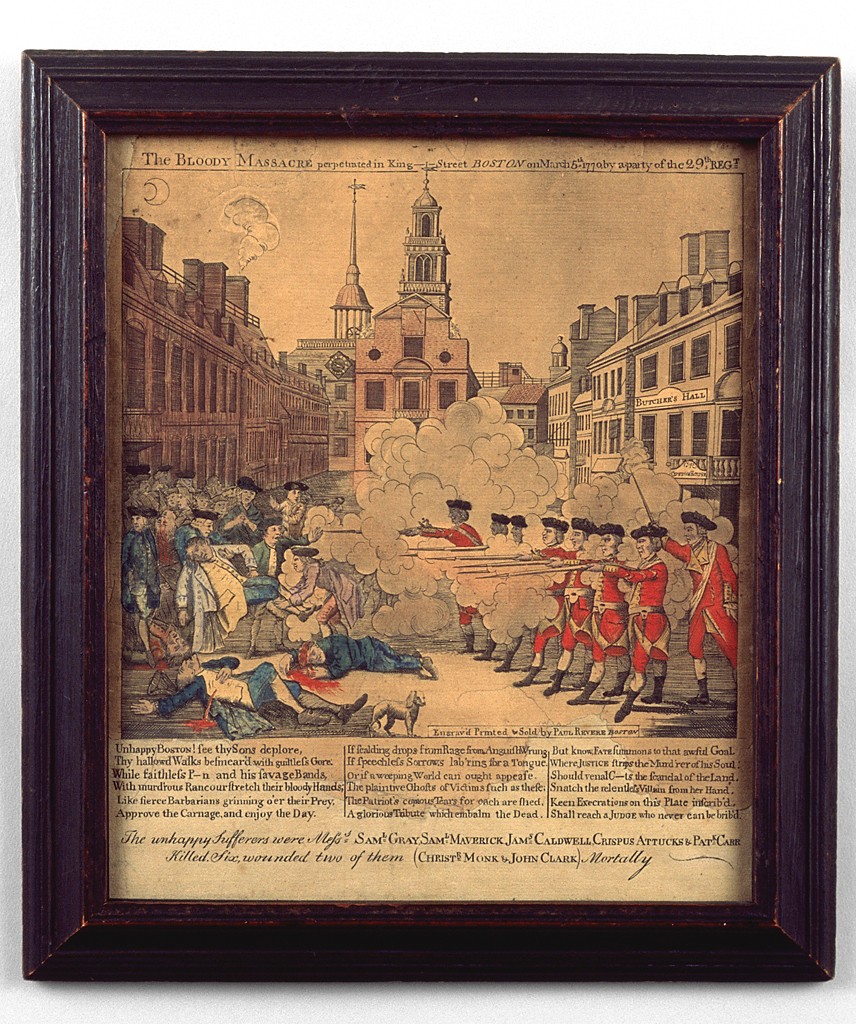
The Bloody Massacre, by Paul Revere Jr. (1734-1818). Boston, Massachusetts, 1770. Paper, ink, watercolor, wood, glass. HD 0864.