Historic Deerfield Mobile
Encountering Pocumtuck Walking Tour App
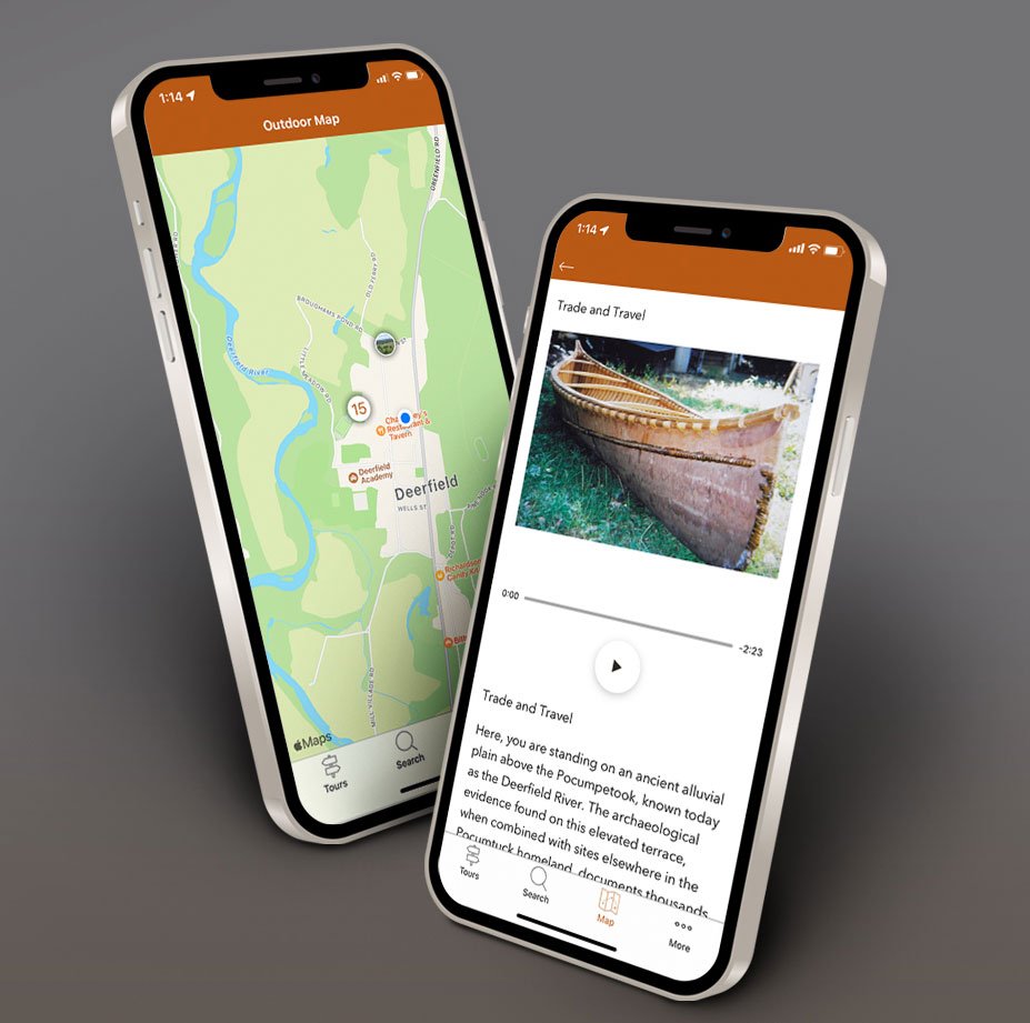
Historic Deerfield’s mobile app is a walk through Deerfield’s Indigenous history. This guided experience features 16 stops in the village of Old Deerfield where you can explore Pocumtuck life, culture, and history in the landscape around you.
Please download the app below, available for iPhone or Android devices.
You can also access the web-based version of the app in a web browser.
FOR THE BEST EXPERIENCE WITH GPS FUNCTIONALITY PLEASE DOWNLOAD THE APP.
Using the app
Please review the tips below and consult the FAQ’s to help answer your technical questions.
Tips for the best user experience
-
Start with the Encountering Pocumtuck: Essential Tour Information stop
Click on the Begin button which will open this first stop. Meet the narrator and hear how the tour is shaped around 4 insights about Indigenous histories and places past and present. There are fifteen more stops that you can visit in any order. We recommend using the Map tool on the menu bar at the bottom of your screen as your primary navigation. The tour was developed with no specific order so you can access stops closest to your location. You can use the app at home. Click the Begin button and at the top left of the screen you will see an icon with three lines. Click on the icon to see a list of all 16 stops and select one to start the tour.
-
Enable location services
This feature activates the GPS Blue Dot Navigation that shows stops nearest to you. To turn on location services within the app click on the Map tool on the menu bar at the bottom, then click on the arrow in the lower right corner. Choose “Turn on Location Services.” You will be prompted to allow “Historic Deerfield” to use your location. Select “Allow While Using App.” Once enabled, a blue dot should appear on the map. If you have trouble, please see: Enable location Services for iPhone / Enable Location Services for Android
-
Use the map tool
We recommend using the map tool to locate app stops nearest to your location.
The stops appear as circles on the map. One click on the circle reveals the name of the stop, a second click opens the stop. If you see a number in a circle, it represents a cluster of stops. You can tap the circle to see individual stops or use your fingers to enlarge the map. When you finish a stop return to the map on the bottom menu bar to select another stop. Don’t forget, the blue dot on the map represents your location and will move in the direction you are moving. -
Consider using headphones
The street can get loud at times. If you are having trouble listening to the narration, we suggest using headphones.
FAQS
How can I download the app? Depending on which type of device you are using, click the Apple or Google Play button above. For more information on downloading an app please see: Download for iPhone / Download for Android
Can I play audio through my hearing aid? Yes. For instructions please see: Connect your hearing aid iPhone / Connect your hearing aid Android
The National Endowment for the Humanities provided financial support for the development of this mobile app. We thank our NEH project scholars Margaret Bruchac (University of Pennsylvania) and Lisa Brooks (Amherst College) for sharing their scholarship and knowledge of Indigenous history and culture.

Tell us what you think.
Is there anything we can do better? Did you Enjoy the app? Did you find our staff to be knowledgeable on the app’s features?
Let us know your experience by adding your feedback below.
(Please note, you will not receive a response to any submissions made through this form, nor will all suggestions be implemented. This channel is a way for us to collect feedback and make improvements over time.)